
A useful address, but not an entrance, path, access procedure, or final pose.
ReadyCar SiteMap / Patent-pending
A street address finds the property.SiteMap finds the work.
An unattended vehicle still has to choose the correct entrance, pass through access controls, follow a vehicle-safe path, and stop at the exact charger, bay, wash lane, inspection point, or staging position. SiteMap turns that facility knowledge into an arrival plan.
Shown here as a provider-guided capture from Fleet Entry A to Tire Bay 3. Illustrative interfaces explain the intended workflow and do not imply commercial deployment at scale.
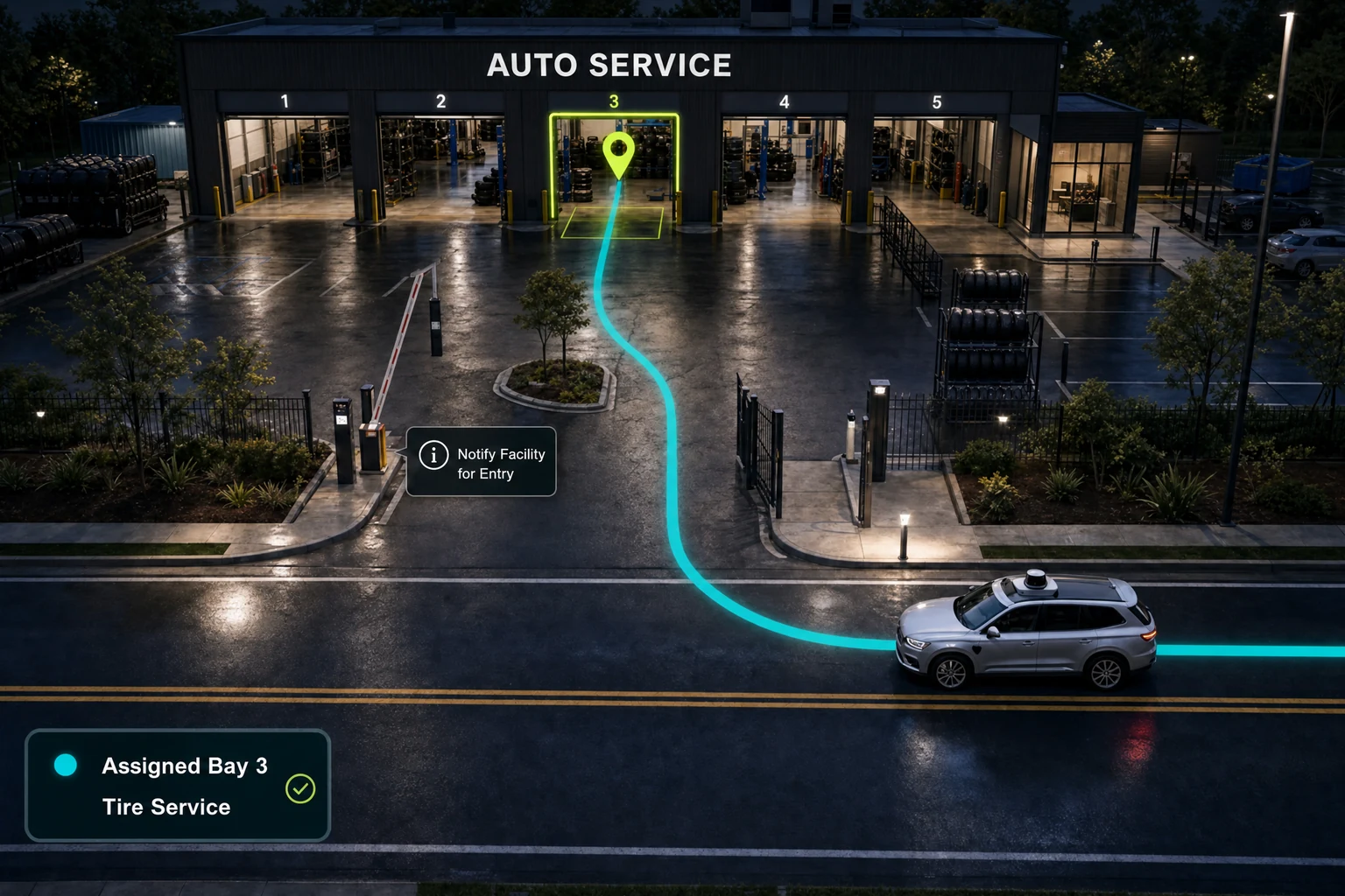
The private-property navigation gap
The map pin is where ordinary navigation stops.The service journey keeps going.
Correct gate. Approved route. Required communication. Exact usable endpoint.
Why SiteMap is necessary
One property.Several decisions a human usually makes.
Which entrance can this vehicle use?
Street maps rarely express fleet gates, access windows, call boxes, waiting points, or facility notification steps.
Which on-site path is approved?
The drivable route must reflect lane direction, turns, obstacles, traffic flow, and provider rules.
Where does the vehicle actually stop?
A building centroid cannot identify a practical charger, bay centerline, wash lane, inspection point, or staging pose.
What changed since the last arrival?
Closed gates, occupied resources, blocked paths, and alternate entrances need to become operating exceptions before arrival.
The SiteMap facility capture tool
Walk the path.Record the environment.
A guided phone workflow lets a facility manager translate practical site knowledge into a reviewable path from a named entrance to a named resource.
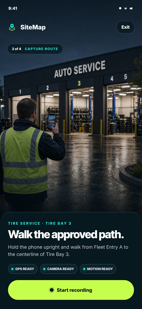 01 / Assign
Name the entrance and resource.
The capture starts with a specific operational handoff—not a general property address.
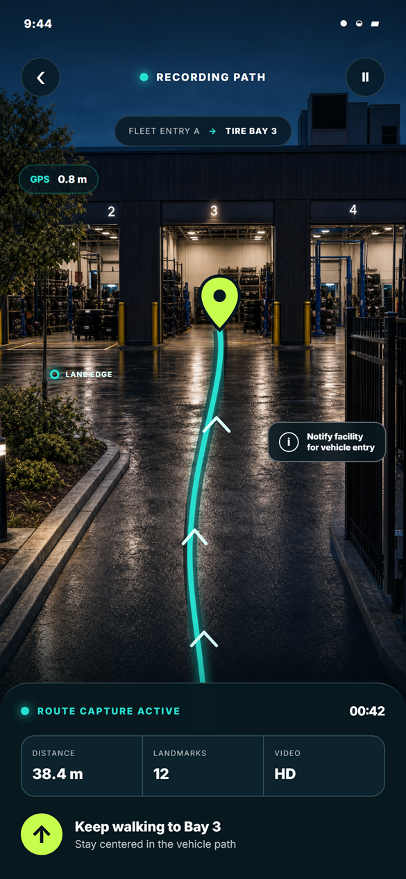 02 / Walk
Record the approved vehicle path.
GPS, motion, video, landmarks, and access instructions stay connected to the route.
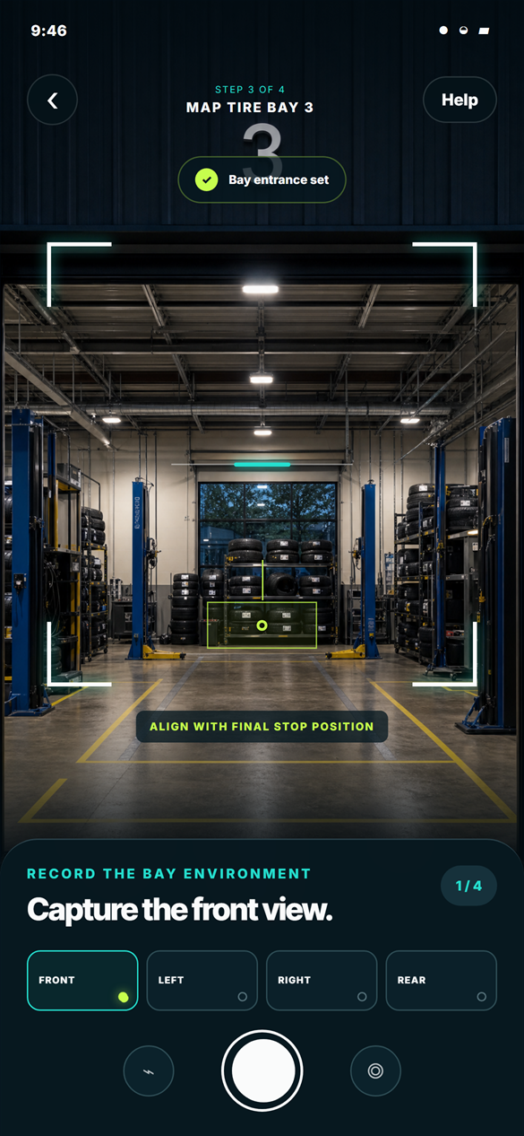 03 / Capture
Document the physical context.
Entrance, bay views, lane edges, approach, and final stop position make the endpoint operationally legible.
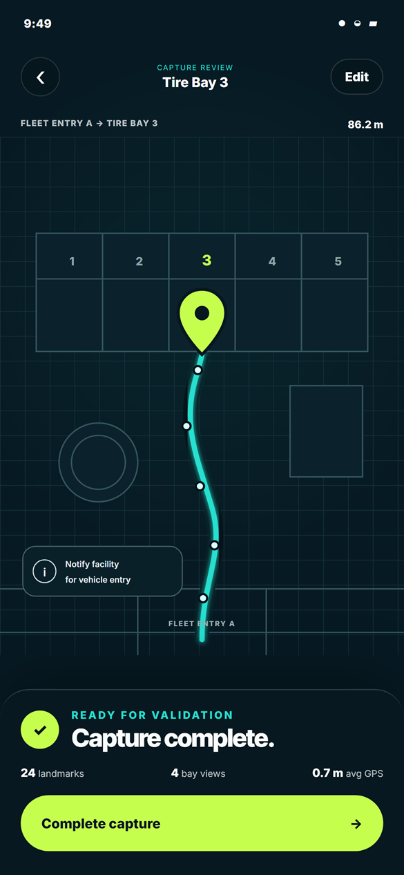 04 / Validate
Review the route as one system.
The entry instruction, continuous path, landmarks, and GPS-anchored service resource are checked together.
The screens show a conceptual SiteMap facility-capture workflow. Illustrative interfaces explain the intended workflow and do not imply commercial deployment at scale.
The vehicle-facing result
Not just coordinates.An operating context.
The fleet or vehicle can receive a facility guidance package that describes how to transition from the public road to a usable physical service resource, while the autonomous-driving system retains responsibility for safe vehicle control.
Clear boundary: SiteMap does not replace the driving stack, facility safety rules, or real-time vehicle judgment. It supplies the missing facility context those systems need.
What SiteMap makes possible
Make more service capacityusable by unattended vehicles.
- For fleetsReplace ambiguous property arrival with a repeatable exact-resource handoff.
- For providersCommunicate the route, access conditions, and final pose their staff already understand.
- For operations teamsTurn facility changes into visible exceptions instead of failed arrivals.